Maps
 Flying Boats Flight Path A diagram showing the flight path of flying boats stationed in the Cromarty Firth during World War 2
 Old Invergordon This map, dating from the middle of the 18th century, shows the area around Invergordon Castle.
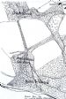 Invergordon Castle This map of 1874 shows the gardens of Invergordon Castle. The position of the pictish stone is marke...
 Invergordon Castle Grounds - 1880 An extract of the 1880 map showing the relative positions of the Cottages (see picture #1254), Iceho...
 Invergordon - 1985 This is a composite of two map sheets, dated around 1985. They are based on surveys over the previou...
Latest Pics