The Invergordon Archive
No: 504 Contributor: The Highland Council Planning Department Year: 2003
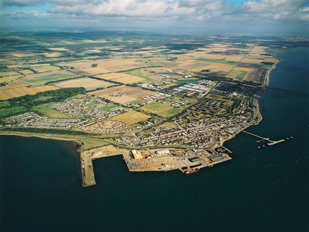
Aerial view of Invergordon


A second aerial view of the town provided by The Highland Council. This view is looking north.
 View Large Version
Picture added on 13 October 2004
This picture is in the following groups
Aerial views taken by The Highland Council Planning Department
Aerial views taken by The Highland Council Planning Department
Can see my old house on Shore Road. But it looks like Shore Rd has changed as it used to curve up to the High Street. I suppose the bend by the old police station would be a rather sharp turning point for large trucks. I take it that the square piece of ground was where the old oil tanks were; by now they are most probably built up with houses.
Added by Doug Will on 22 September 2015
Doug, in fact there is little change in Shore Road itself between the Ship Inn and it's junction with High Street at the Police Station. The railway tracks on the south side of Shore road were lifted and a new road around the coast was built on the line of the railway. This new road carries through traffic and traffic entering and leaving the port.
Housing has been built on the western end of the old Cromlet tank farm, including the childrens play park, but the eastern end is still vacant.
Housing has been built on the western end of the old Cromlet tank farm, including the childrens play park, but the eastern end is still vacant.
Added by Ron Stewart on 23 September 2015
Hi Ron, thank you for the info on Castle Road field. They really have built on that bit along the old Bulls hill; the town has really spread out since I left - haven't been home since the early '60s.
Cheers, Doug Will
Cheers, Doug Will
Added by Doug Will on 25 September 2015
Aerial views taken by The Highland Council Planning Department


