The Invergordon Archive
No: 503 Contributor: The Highland Council Planning Department Year: 2003
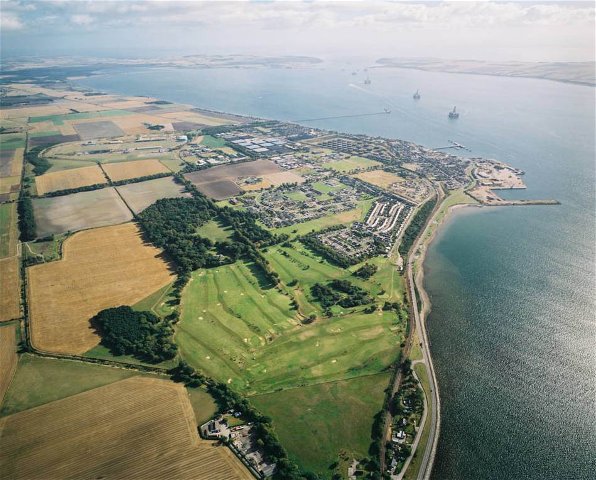
Aerial view of Invergordon and the Cromarty FirthThis is one of three aerial views taken for the Planning Department of the Highland Council as part of their appraisal of land use.
This view is looking east with the golf course in the foreground.
 View Large Version
Picture added on 13 October 2004
This picture is in the following groups
Aerial views taken by The Highland Council Planning Department
Aerial views taken by The Highland Council Planning Department
Harry I would say the building in question is belonging to MacDonald Scaffolding showing house and yard just behind Rosskeen Graveyard which is just out of the frame of the picture. Rosskeen burn is in the trees just alongside the yard/buildings and you can trace it as far as Ord Farm past the Black Ditch.
Added by Duncan Murray on 21 December 2007
Nice picture, lots of changes since this was taken though.
Anonymous comment added on 21 April 2012
What would the changes be? I hope the trees are still there.
Added by Harry O'Neill on 21 April 2012
Trees are mostly still there although there is now a large housing development (50+ houses) on the old golf course land (the gap in the middle between Birchwood and Ness Gardens/Caberfeidh Drive) which is unfortunately been plonked directly in front of my house.
Added by JillianB on 26 April 2012
Aerial views taken by The Highland Council Planning Department


You can see the path that goes around from Rosskeen to the Castle Rd.