The Invergordon Archive
No: 1397 Contributor: John Robertson Year: 1927
Novar Airfield


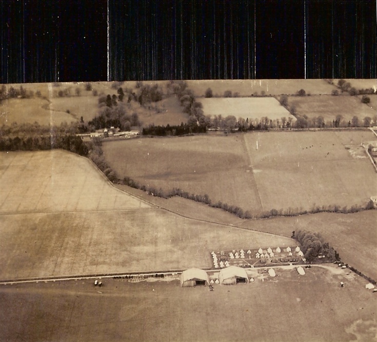
Aerial shot showing the tented layout of Novar during a squadron detachment, in 1927.
Picture added on 14 November 2010 at 11:15
This picture is in the following groups
Novar Airfield
Novar Airfield
Can anyone tell me if the building in the background was the Newton farm site of 1797?
Added by David L Munro on 11 February 2011
I always remember that area you mention known as Tallysow (meaning Inn or soildiers' Billet) Newton area is just along to the left. Newton house is still there and there are buildings there that might have been steadings at one time.
Added by Mairi Crow on 12 February 2011
Is Newton farm House closer to the old Kiltearn Church near the site of the Ford on a 1900 map. or just behind this set of buildings to the left in this picture? On a Google air map there are three sets of buildings between the main water run and (a smaller water run or it a row of trees) which is just in front of the buildings in this photo.
Thanks for your help
Thanks for your help
Added by David L Munro on 14 February 2011
I have a map that shows Newton farm located approximately opposite the junction that goes into the Deephaven industrial estate to the Technip base. There are still buildings and houses there - the farm would be just a few hundred metres to left in the picture (which is not shown).
Added by Mairi Crow on 14 February 2011
The buildings shown above the tented camp are definitely Tallysow, the blacksmiths shop and smiddy would still have been active then. The building that has been cropped off at the top of the page would be Novar House with the Big Burn meandering through the field to Tallysow. The Big Burn then follows the line of the trees to just above the tented camp and the heads towards Wester Teaninich farm. The course of the Big Burn has been altered and passes the west corner of the Isleburn hangar.
Added by Alan Kinghorn on 07 April 2013
Novar Airfield


